(
(10/01/2023
QuickGNSS – the new quality of measurements with Android
|
 From the end of 2019 QuickGNSS is on sale. This is the brand-new app to make GPS measurement on Android created by the surveying software company Cubic Orb!
QuickGNSS - effective, intuitive, and tested by many satisfied specialists
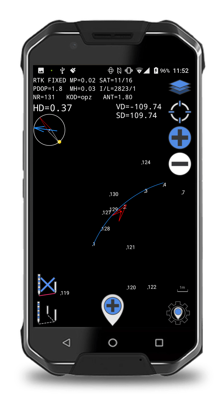
Before we introduce the app into the market QuickGNSS has been verified for almost two years by Satlab’s receivers users. Specialists using other receivers such as Trimble, Spectra Precision or Stonex also had possibility to try out QuickGNSS before its premiere. Cubic Orb is not only the creator of the software but a surveying company. We strongly and successfully used and tested QuickGNSS in our day-to-day field works. Such versatile tests have given us the ability to present the proven and practically verified product. The app won many satisfied users before it even enter the market! During the creation of QuickGNSS we focused on ensuring maximum comfort of using, effectiveness, intuitiveness and stability. Many surveyors just after short term experience with the app claim that they will never change QuickGNSS for other solutions. It states that we have achieved our goals. The software is exceptionally intuitive – does not require any training! Its impressive capacities allow to smoothly work on hundreds of thousands points and large dxf files. The measurement is efficient and effective thanks to, among others, using 5Hz frequency in staking and measurement.QuickGNSS in measurement and staking
QuickGNSS has all functions necessary to ensure the highest standard of measurement. The user can make averaged, single point, tracking (including these with echo sounder) measurements. The specialists can also measure temporary points and simply edit measured points (from the map level). Field works are even more comfortable thanks to ongoing preview of solution parameters (like RTK fixed), coordinates and basic settings of a measurement and staking as well as an intelligent compass. QuickGNSS contains also a number of the most popular staking options (point, line, point and line from a vector of a map, point projected on a line, line with more than one bend). You can stake out arcs and circles (including segmentation),. Defining an arc (also by indicating a vector on a map) is also possible. Finally the specialists can stake out main points of the arc and a centre of a circle.