Cubic Orb Software
Cubic Orb land survey software is created by practicing surveyors and resolves practical problems you can come across in surveying work. Our software has supported land surveyors for many years. It gained recognition of more than 1300 specialists! Try Cubic Orb software to make your field and office work more comfortable, efficient and effective!

WHY LAND SURVEYORS LOVE CUBIC ORB SOFTWARE?
With Cubic Orb software you can:
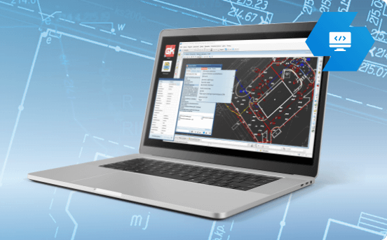
- work on almost every CAD – our plugins supports all popular CAD platforms (BricsCAD, AutoCAD, Microstation and many more)
- avoid training – Cubic Orb software is intuitive and easy-to-use
- make your survey works super-efficient – our software ensures maximal optimization of surveying processes
- get more for less – lots of functionalities for a moderate price
- work succesfully in other areas – Cubic Orb software can be applied to related industries (construction, designing, GIS)
- fit the licence for your needs – we have various licences adjusted to meet every user’s requirements
- solve your real survey concerns – Cubic Orb software is created by practitioners and solves practical problems in land survey
Meet Quickgnss
bestseller
Quickgnss
Test for free
30-day test period
Read more
OTHER SOFTWARE


Customer Reviews
Podlaski Serwis Geodezyjny sp. z o.o.
Łukasz Szeluga
Cubic Orb software is created by surveyors and programmers, so they know what kind of solutions need to be implemented in order to solve real problems encountered in this industry,
Białystok, PL
GEOSAT
Stanisław Dwornik
I recommend Cubic Orb as high class specialists.
Szczecin, PL
Gradus s.c.
Mieczysław Kurzynoga
I can’t imagine doing office works without using Cubic Orb software
Wrocław, PL
GNAM
Henryk Amerski
The software developers at Cubic Orb are open to any suggestions from users.
Gorzów Wielkopolski, PL
blog
![]() 2 min
2 min
Adjustment points in quick drawing of the grid
Adjustment points in quick drawing of the grid
Click to Start Warp "with quick drawing of the grid" on the Warp tab. In the Coordinates of first cross...
28/08/2023
![]() 2 min
2 min
![]() < 1 min
< 1 min
TFW – problems with georeferencing files
TFW – problems with georeferencing files
Some versions of IntelliCAD allow the insertion of a georeferenced raster without using KaliBro. The advice below refers to such...
28/08/2023
![]() < 1 min
< 1 min
![]() 2 min
2 min
Defining adjustment points with lines
Defining adjustment points with lines
Select any drawing layer and set the desired parameters for the lines to be drawn. There must be no other...
28/08/2023
![]() 2 min
2 min
![]() 2 min
2 min
Editing of adjustment points
Editing of adjustment points
The editable table on the Warp tab (full view) shows all adjustment points. All loaded points have a status of...
28/08/2023
![]() 2 min
2 min
![]() 2 min
2 min
Problems with retaining the current position arrow and compass
Problems with retaining the current position arrow and compass
On the OPTIONS tab select COMPASS SETUP. If the current position arrow or compass is malfunctioning, change the Compass setup....
28/08/2023
![]() 2 min
2 min
Contact
Do you have any questions or want to contact us? Choose a convenient form of contact for you!